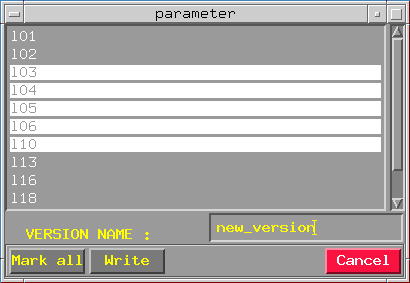
Create version entry dialog appears :
Names which are displayed in the list - are the names of all seismic sections existing in your 2-D project for which horizon, selected and loaded in HORAN - Start option ("Load horizon" option) was traced. User marks all sections he need, inputting version name ("new_version" - for example) and clicking on button "Write" runs the parameter calculating procedure. New parameter version will be wrote into "*.par" file for current horizon. This version and any other version can be send to griding module using HORAN - Grid version option.
Grid version dialog appears :
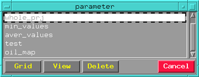
Names which are displayed in the list - are the names of calculated parameter versions. User can delete highlighted version pressing "Delete" button, view contents of the highlighted version. When pressing "View" buttons - view version contents dialog appeared :
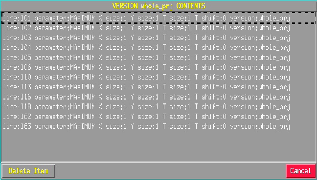
(sorry, bad quality picture, I had to resize it because of its big length!)
The example of up shown list line is :
That's all attributes that identificates calculated parameter :
Line
Section name for which parameter was calculated.
parameter
Name of calculating function.
XSize
Calculating window width.
YSize
Calculating window thickens. (It's working only with 3-D data.)
TSize
Calculating window height.
TShift
Calculating window shift.
version
Name of current version.
By "Grid" button pressing highlighted version can be send to griding module which gives standard map file in SCS-5 format. Map file can be visualised in GERMES-3 mapping section. See visualisation results for more information.